Lake Titicaca
In the Altiplano between Peru and Bolivia,
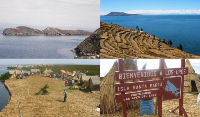
the limpid waters of Lake Titicaca are very important to the Inca mythology and history. According to the Incas, the origin of the world was here, the sun, the moon and the stars emerged from the waters of the lake, the powerful spirits and Spanish gold is in its depths. Lake Titicaca is the highest navigable lake in the world at 3812 m (12,503 ft). The lake is 176 km (110 mi) long and 50 km (31 mi) wide, have a depth of 281 m (922 ft). More than 25 rivers and glaciers of the mountains in Altiplano flows to feed the lake. There are 41 islands in the lake, inhabited by Indians Quechuan. The extraordinary floating islands “Islas Flotantes” are a major tourist spot and used to be called Uros Islands. The reed islands needs constant repairs to stop them rotting. These islands were built by the Uro Indians to avoid the harassment of Spanish colonist, now are settled by the Aymara Indians who have built even a church. They float on the lake surviving from the tourism and the fishing. Don’t miss the Islands of Amantani and Taquile, an overnight stay is possible. Don’t miss also the Isla del Sol. From the Bolivian side you can visit the lake from the city of Copacabana. You can get Puno the nearest town, from Lima (1315 km/822 mi), Cusco (389 km/243 mi) or Arequipa (188 km/117 mi). It’s one of the most beautiful places to visit in South America. Hotels in Puno
Map of Lake Titicaca
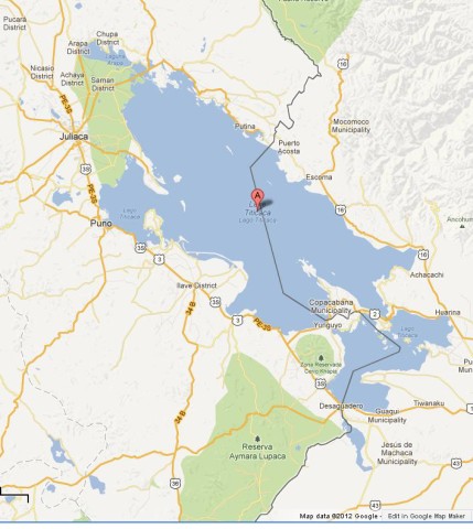
Map of Lake Titicaca
Where is Lake Titicaca on Map of Peru and Bolivia
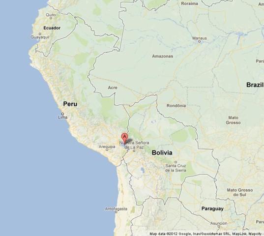
Where is Lake Titicaca on Map of Bolivia and Peru