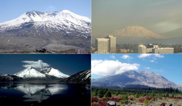
Mount St Helens
Known as “Fuji of America,” Mount St. Helens
attracts visitors to see the destruction that caused the volcano on May 18, 1980 at 8:32 am. It was one of the strongest volcanic eruptions recorded to date, a 5.1 earthquake on the Richter scale originated a large avalanche of debris, the height of Mount St Helens decreased from 2950 m (9677 ft) to 2550 m (8364 ft). A few seconds after the earthquake, the destruction began with lateral blast of hot gas, snow and ice melted from the top to the derived temperatures of 300 º C (572 º F), creating strong currents of water and rocks. The ash cloud reached 19 km (12 mi) and strong winds carried more than 540 million tons of ash to the U.S. skies. Homes were destroyed, also roads, bridges and all that stood around, much of the Pacific Northwest was covered with dust. The Mount St Helens is 80 km (50 mi) away from Portland, Oregon. July to September are the best months to visit this place. Hotels in Portland
Tickets: There is a single day admission ticket, 16 years or older (8$usd), 15 years or below (free).
Where is Mount Saint Helens on US Map
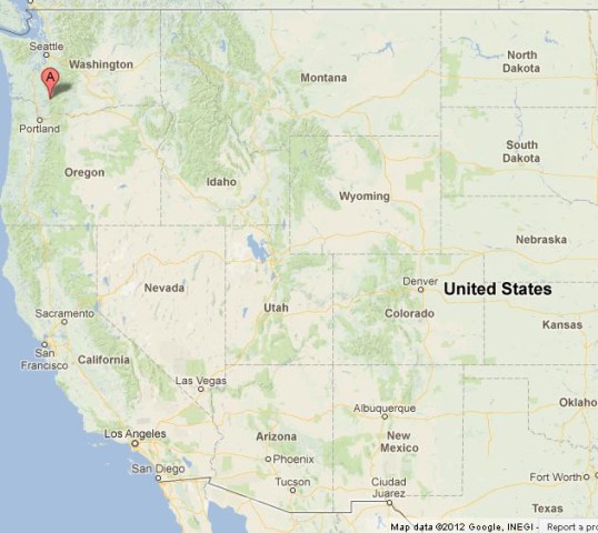
where is Mount St Helens on US Map